Tuesday, October 28, 2008

early wet snow

Yes, your eyes are working. :-) We had a very sloppy day with some wet snow in my area. I had to drive to a mall about 25 miles away to pick up my computer from the Apple Store and it was a messy drive to the mall with a heavy wet snow falling for most of the trip. By the time I left the wet snow was beginning to taper off. I saw two trucks from my local roads department sanding the roads.

I would say that we had a coating of wet snow on our lawn and by the time I got home from the mall, a very light slushy accumulation on the roads.

Go here for some pictures.

I copied this public information statement with a 7:45 PM time stamp on Oct. 28 from my local noaa webpage. If you need help locating this public information statements on this noaa webpage, click on the text products icon and then go to public information statements. The current statement will be displayed and you can easily select prior statements.

PUBLIC INFORMATION STATEMENT
SPOTTER REPORTS
NATIONAL WEATHER SERVICE MOUNT HOLLY NJ
745 PM EDT TUE OCT 28 2008

THE FOLLOWING ARE UNOFFICIAL OBSERVATIONS TAKEN DURING THE PAST 24 HOURS
FOR THE STORM THAT HAS BEEN AFFECTING OUR REGION. APPRECIATION IS EXTENDED
TO HIGHWAY DEPARTMENTS...COOPERATIVE OBSERVERS...SKYWARN SPOTTERS
AND MEDIA FOR THESE REPORTS. THIS SUMMARY IS ALSO AVAILABLE ON OUR
HOME PAGE AT WEATHER.GOV/PHI

********************STORM TOTAL SNOWFALL********************

LOCATION STORM TOTAL TIME/DATE COMMENTS
SNOWFALL OF
(INCHES) MEASUREMENT


NEW JERSEY

...ATLANTIC COUNTY...
POMONA T 250 PM 10/28 ACY INTL AIPRORT

...BURLINGTON COUNTY...
MOUNT HOLLY 0.1 245 PM 10/28 NWS OFFICE
CROSSWICKS T 1048 AM 10/28
MOUNT LAUREL T 420 PM 10/28

...HUNTERDON COUNTY...
LEBANON 12.0 500 PM 10/28 950 FT
CHERRYVILLE 5.0 400 PM 10/28
HIGH BRIDGE 2.4 130 PM 10/28
CLINTON 1.7 300 PM 10/28
FLEMINGTON T 825 AM 10/28
FLEMINGTON T 420 PM 10/28

...MERCER COUNTY...
HOPEWELL 2.5 425 PM 10/28
EAST WINDSOR T 1030 AM 10/28
EWING T 915 AM 10/28
HAMILTON SQUARE T 1032 AM 10/28
MERCERVILLE T 1052 AM 10/28
PRINCETON T 900 AM 10/28

...MIDDLESEX COUNTY...
NEW BRUNSWICK 1.5 130 PM 10/28
EDISON 1.0 1130 AM 10/28

...MORRIS COUNTY...
MOUNT OLIVE 11.5 520 PM 10/28 AT 1000 FEET
LONG VALLEY 8.0 420 PM 10/28 AT 1200 FEET
FLANDERS 5.5 730 PM 10/28
LAKE HOPATCONG 3.0 730 PM 10/28
MOUNT OLIVE 3.0 130 PM 10/28
BUTLER T 730 PM 10/28

...OCEAN COUNTY...
TOMS RIVER T 100 PM 10/28

...SOMERSET COUNTY...
HILLSBOROUGH 1.2 130 PM 10/28
PEAPACK 1.0 1117 AM 10/28
BRIDGEWATER 0.3 130 PM 10/28
BEDMINSTER T 1045 AM 10/28

...SUSSEX COUNTY...
HIGH POINT STATE 14.0 400 PM 10/28
WANTAGE 4.5 420 PM 10/28 AT 1020 FEET
BARRY LAKES 3.0 725 PM 10/28
NEWTON 2.5 730 PM 10/28
SPARTA 2.0 725 PM 10/28 UP TO 5 HIGHER TRRN
LAFAYETTE 0.5 130 PM 10/28

...WARREN COUNTY...
HACKETTSTOWN 4.8 420 PM 10/28
HACKETTSTOWN 4.0 645 PM 10/28
ALLAMUCHY 3.0 1105 AM 10/28
BLAIRSTOWN 0.5 730 PM 10/28
STEWARTSVILLE T 420 PM 10/28

PENNSYLVANIA

...BUCKS COUNTY...
JAMISON 3.0 230 PM 10/28
CHALFONT 2.0 400 PM 10/28
FAIRLESS HILLS 1.5 736 PM 10/28
FURLONG 1.2 230 PM 10/28
DOYLESTOWN 1.0 130 PM 10/28
LANGHORNE 0.8 230 PM 10/28
BENSALEM 0.5 230 PM 10/28
LEVITTOWN T 1040 AM 10/28
SPRINGTOWN T 720 AM 10/28

...CARBON COUNTY...
ALBRIGHTSVILLE 6.0 1115 AM 10/28 ELEV. AROUND 1700 FEET
JIM THORPE T 700 AM 10/28
PALMERTON T 700 AM 10/28

...MONROE COUNTY...
TOBYHANNA 16.0 700 PM 10/28 POWER OUTAGES
POCONO SUMMIT 4.5 1100 AM 10/28

...MONTGOMERY COUNTY...
MONTGOMERYVILLE 2.0 420 PM 10/28
SOUDERTON 1.5 1140 AM 10/28
WILLOW GROVE T 700 AM 10/28

...PHILADELPHIA COUNTY...
PHILADELPHIA T 1124 AM 10/28 NE

***********************PEAK WIND GUST***********************

LOCATION PEAK WIND TIME/DATE COMMENTS
GUST OF
(MPH) MEASUREMENT


DELAWARE

...KENT COUNTY...
DOVER AFB 47 513 PM 10/28

...NEW CASTLE COUNTY...
WILMINGTON 47 510 PM 10/28
NEW CASTLE 45 457 PM 10/28

...SUSSEX COUNTY...
LEWES BEACH 47 900 AM 10/28 BREAKWATER HARBOR

MARYLAND

...CAROLINE COUNTY...
RIDGELY 44 100 PM 10/28

...KENT COUNTY...
TOLCHESTER BEACH 44 1100 AM 10/28

...TALBOT COUNTY...
EASTON 39 1053 AM 10/28

NEW JERSEY

...ATLANTIC COUNTY...
ATLANTIC CITY 50 416 PM 10/28 INTL AIRPORT
ATLANTIC CITY 44 400 PM 10/28 MARINA

...BURLINGTON COUNTY...
MOUNT HOLLY 38 339 PM 10/28

...CAPE MAY COUNTY...
CAPE MAY 66 258 PM 10/28
CAPE MAY 59 730 PM 10/28 FERRY
WILDWOOD 50 255 PM 10/28

...CUMBERLAND COUNTY...
NEWPORT 48 700 PM 10/28
MILLVILLE 47 220 PM 10/28

...MERCER COUNTY...
TRENTON 36 1229 PM 10/28

...MONMOUTH COUNTY...
KEANSBURG 47 1100 AM 10/28
BELMAR 39 235 PM 10/28

...OCEAN COUNTY...
BARNEGAT LIGHT 50 400 PM 10/28
TOMS RIVER 36 435 PM 10/28

...SUSSEX COUNTY...
HIGH POINT STATE 52 250 PM 10/28

PENNSYLVANIA

...BERKS COUNTY...
READING 54 430 PM 10/28

...BUCKS COUNTY...
DOYLESTOWN 37 531 PM 10/28

...CHESTER COUNTY...
COATESVILLE 51 240 PM 10/28

...LEHIGH COUNTY...
ALLENTOWN 43 537 PM 10/28

...MONROE COUNTY...
MT. POCONO 43 445 PM 10/28

...MONTGOMERY COUNTY...
PHILLY WINGS F 44 520 PM 10/28
POTTSTOWN 38 202 PM 10/28
WILLOW GROVE NAS 38 534 PM 10/28

...PHILADELPHIA COUNTY...
PHILADELPHIA/NE 43 531 PM 10/28 NE AIRPORT
PHILADELPHIA 40 551 PM 10/28 INTL AIRPORT

final update on Sauders Ditch Fire

Sorry for the delay in posting this update. The forum thread about this fire on wildland fire reported yesterday morning (27 October) that the fire is 100% contained after the area received .58 inches of rain over the weekend with some smoke. Mop up continues. Acreage burned is 1,950.

And see this newspaper article.

I expect that the received more rain today, not as much as I did, but perhaps they received enough rain to help the remaining firecrews who are mopping up.

Friday, October 24, 2008

Sauders Ditch Fire - 70% contained

I have been relying on reports posted to wildland fire as my primary source for my posts about this fire. According to this mornings report (8:30 AM EDT on 10/24/08), 1,950 acres have burned and the fire is 70% contained. The main problem has been heavy smoke conditions made worse by inversion. Heavy smoke lead to the closure of U.S. Route 206 at 10:30 PM last night. Schools in nearby Hammonton Township are closed today as well.

Officials expect to reopen the highway once the inversion lifts this morning. Weather reports calls for winds from the east which are expected to clear the smoke for the highway and from the nearby town of Hammonton, NJ.

Thursday, October 23, 2008

Sauders Ditch Fire update

According to a Star Ledger report around mid-day, the fire is at 50 percent containment and is not expected to spread outside of the remote area where it is burning unless there is "sudden increase in winds."

Route 206 in the area of the fire may be reopened today.

Wednesday, October 22, 2008

Sauders Ditch Fire (Pine Barrens, NJ)


The fire that I wrote about last night, aka the Sauders Ditch Fire, continues to burn tonight according to reports on wildlandfire.com. The fire jumped U.S. Route 206 last night, and the areas of greatest concern are to the east of the highway. Winds are an issue.

The report (written about noon today) reports that air support in the form of two helicopters and a fixed wing aircraft were scheduled to be deployed around mid day for water drops.

The Star Ledger reports that the fire has charred 1,800 acres and is 40 percent contained. Residents in four houses who evacuated yesterday were allowed to return today. Rain is not expected until this weekend so the fire may not be controlled until then or later, depending on the rainfall.

If I understand what I have been reading on wildlandfire about this fire, the fire started on the west side of U.S. 206 in the Atsion area before jumping the highway to the east side. The graphic is from google earth with a (kml) file from the modis active fire mapping program of the U.S. Forest Service. I can't speak for how up to date this information is as the modis files shows no fires east of U.S. 206 yet the latest reports that I saw all speak of fires to the east of the highway. At the very least this gives you an idea of the locale of the Sauders Ditch fire.

Tuesday, October 21, 2008

Fire in NJ Pine Barrens

There is a wildfire in the NJ Pine Barrens in the Warton Forest area. See this report from the Wildland Fire website. And see this article.

Early reports say this is a fast moving fire capable of burning 1,000+ acres. Part of the area was burned in August 2007 reducing fire behavior in that area.

Not a surprise, it has been dry recently and I was on the NJ Forest Fire website earlier today where they reported a high fire risk for the Pine Barrens.

Saturday, October 18, 2008

Revisions to yesterdays post

For those of you who are interested and may have already read the post I made yesterday on Burned Area Emergency Response, I just made some modifications that I hope will provide further clarifications.

Friday, October 17, 2008

Burned Area Emergency Response

In July, I wrote about the Basin Complex fire that burned portions of the Los Padres National Forest. I wondered what was heppening in Los Padres in the aftermath of the Basin Complex and the Indians Fires. These two fires burned a total of 240,170 acres broken down as follows.

National Forest Service acres: 197,497
Other federal lands: 13,066
State: 5,248
Private: 24,263

In checking out the Los Padres website, I learned about the U.S. Forest Service's Burned Area Emergency Response (BAER) Program.

After a fire on U.S. Forest Service lands, the Burned Area Emergency Response (BAER) program kicks in. The goal of BAER is to to protect
life, property, water quality and deteriorated ecosystems from further damage from flooding and other natural events after a fire. A Forest Service BAER Team was convened in August to assess the entire burn area. Members included specialists in hydrology, soil science, geology, biology, botany, archaeology and engineering. The Team coordinated with local, state and other federal agencies to discuss assessment findings, values at risk and treatment options.

The objectives of the BAER program are to:

* Determine if emergency resource or human health and safety conditions exist.

* Alleviate emergency conditions to help stabilize soil; control water, sediment and debris movement; prevent impairment of ecosystems; and mitigate significant threats to health, safety, life, property and downstream values at risk.

* Monitor the implementation and effectiveness of emergency treatments.

In August, the Forest Service released this rehabilitation and emergency response update where the BAER team reports there early findings including a summary of acreage burned and post-fire ecological vulnerabilities.

In late September, the U.S. Forest Service released the BAER plan for U.S. Forest Service properties burned in the Basin Complex and Indians Fires. The approved initial BAER report may be found here (adobe reader required).

One of the responses under BAER is applying hydromulch to burned areas. According to the current conditions page of the Los Padres website:
Hydromulch will be applied by aircraft to about 1500 acres in the Gap Fire area. Hydromulch is an all-organic mix of paper/wood fiber, water and a binding substance. It helps hold the soil in place to minimize erosion, trap moisture and create an environment in which the native seeds and roots already present in the soil can sprout. The green dye in the hydromulch helps the pilots see where they have made their drops, but the color will fade to a light brown within a short period of time. Treatments are scheduled to begin on September 24 and will take 3-4 weeks to complete. The treated areas will be closed to all public entry for the first year to protect the hydromulch cover.

The first phase of hydromulching was completed on October 6. A map of the hydromulched area may be found here.

Not that the 1,500 acres that were hydromulched in this first phase account for only a very small percentage of total acres burned (197,497) in June and July on National Forest Service Lands. If my understanding of the Approved Initial BAER Report is correct, many high to moderately burned acres in Los Padres were on very steep slopes. Hydromulch can not be applied if slopes are very steep, so many high and moderately burned acres do not fit the rules or conditions for hydromulching and will not be treated.

I expect that the Forest Service will continue to provide updates on the Los Padres current conditions page. I'll be checking this page from time to time.

November 19, 2015: Unfortunately all or most of the links in this article are outdated and no longer available. The USFS page for Los Padres did have information on the BAER for the Station Fire that have since been removed. I am sorry. 

Thursday, October 16, 2008

Santa Ana Winds

I found this webpage with a good brief description of Santa Ana winds by Robert Fovell, Professor of Atmospheric and Oceanic Sciences at the University of California, Los Angeles. He also includes a model of a typical Santa Ana event in California that you weather buffs might enjoy. Finally he has a good FAQ page.

California wildfires

Some of you may have heard about the recent wildfires in California on the news. Capt. Mike of the Firefighter blog has been writing about these fires. He has labels on his blog, so to make it easier for you, I used his label to provide you with what I hope is an easy to use link to his writings about Santa Ana winds and wildfires, including the recent wildfires in CA. This will take at least a couple of minutes to load, perhaps longer if you have a slower internet connection.

Briefly, as I understand it, Santa Ana winds can make wildfires in CA worse. I believe that this time of year, early fall, is (one?) of the seasons for Santa Ana winds. Dry conditions and Santa Ana can lead to deadly wildfires, ones that are difficult to fight. Sometime in the coming days, I'll try to find some specific information on the web talking about the relationship between Santa Ana winds and wildfires for you. In the meantime, take a look at this wikipedia link.

I am going to work on going back and putting labels in my blog, at least going back for the last three months in hopes that it will make easier to follow the topics that I am writing about.

Wednesday, October 15, 2008

What is happening at Lost Padres?

I went to the Los Padres National Forest website recently to see what has been happening in the aftermath of the Basin Complex Fire that I wrote about in the Summer. There were, I think, two fires at Los Padres, the Basin Complex and the Indians Fires. For the moment, I am going to post the link to this page at the Los Padres National Forest where current conditions are discussed, including but not limited to post-fire responses in the aftermath of the June 2008 fires.

Monday, October 13, 2008

wildfire terminology


I was looking around on the internet last week for some basic information about the anatomy of a wildfire along with some definitions of some of the terminology that is commonly used by those who write about wildfires. I found this short reference on wildfires produced by the South Carolina Forestry Commission in 1994.

The graphic that I am including in this post is from the SC Forestry Commission, they are also the source for the terminology discussion below.

A wildfire is any outdoor fire (forest, brush, grass, etc) that is not controlled or supervised.

Fires need fuel, heat, and oxygen (aka the fire triangle) to burn. Structural fires are typically attacked with water to reduce heat or foam to take away the fires oxygen supply. Wildland fire fighters remove flammable materials from the path of the fire, attacking the fire's source of fuel.

A variety of tools are used to remove fuel from a strip of ground called a fire or fuel break. One tool that I have frequently seen referred to is called a backfire or drip torch that is used to widen firebreaks by burning out fuel between the firebreak and the oncoming fire.. It consists of fuel canister filled with a mixture of diesel and gasoline with a wick-like burner attached to the canister by a long tube. The fuel ignites as it passes the burning wick dropping on the ground to ignite leaves, pine needles, and other detritus on the ground.

The head (see graphic) is the fastest moving and most dangerous part of the fire. According to the SC Forestry Commission, "since this is the portion of the fire that causes the most damage, firefighters try to stop the head first." On large fast-moving fires, several firefighters may plow side by side to create a firebreak wide enough to stop the head.. After the wildland fire fighters have stopped the forward progress of the head they construct firebreaks around both flanks and the rear to contain the fire. The next step is to mop up the fire by putting out any remaining hot spots and/or other spot fires, and reinforce their firebreaks. A fire is not considered to be controlled until the mop-up phase is completed.

Addendum: I am adding this addendum a few hours later. I have already been on another web page from the State of Maryland where they say that "firefighters usually start building a fireline at the place where the fire originated and work along the sides of the blaze toward the burning front." Note the use of the term fireline, which they say "looks a lot like a trail or small road, is a strip of land cleared of flammable materials like plants and shrubs."

To this novice, a fireline seems to be synonymous with a fire or fuel break. Moreover the folk from Maryland seem to have different take on where the wildland fire fighters start to build a fireline or firebreak to work towards containing the fire. Perhaps the point is that the methods for fighting a particular fire including where firefighters start building a firebreak, if indeed they even do this first, will vary depending on the characteristics of the wildland fire itself. All I am aiming to do here and in later posts is to get a handle on some of the terminology used in fighting wildland fires and related issues and to offer this to you along with links for you to peruse at your leisure.

Friday, October 10, 2008

Condor Chick survives Basin Complex Fire

I am starting to poke around on the various websites that I was following last July when I wrote about The Basin Complex Fire in Los Padres National Forest. One of the blogs that I heard of in the course of my wonderings is a blog called the firefighter blog. The blogger is Capt. Mike, ret(ired), and my take is that he is a retired fireman. I never really checked out his blog in July, rather I decided to go back to this blog at a later time.

The time has come for me to check out this blog, which I am in the process of doing as I write this. I found this interesting post: From the ashes; Condor chick survives The Basin Complex Fire including a you tube video from the Ventana Wilderness Society reporting their discovery of the chick.

I am awed by the tenacity of nature, how nature -- in this case a Condor Chick and parent(s) -- survived the fire. Nature does find a way, if we let her.

Since I have been promising to post some follow-ups about what is going in Los Padres National Forest following The Basin Complex Fire, I thought that the story of the Condor chick is a good place to start.

Thursday, October 09, 2008

Delaware River (part 3): a culvert along the canal

I took a drive down to check out a section of the Delaware and Raritan Canal about two miles south of Lambertville, NJ yesterday afternoon. I wanted to check out some markers that I first saw when I went to that section of the canal last March. The markers, near a culvert, turned out to be uninteresting.

But I was interested in the culvert, so I am attaching two photos of the culvert, one from each side of the culvert. When I went back yesterday, I was struck by the much lower level of the Delaware River as compared with March 6, 2008 (bankfull). I am including two pictures looking from the towpath along the canal at the culvert looking towards the Delaware River. One, taken in March, shows the River at bankfull. The other, taken yesterday from about the same spot, shows the River at a significantly lower level, probably more along the lines of a "normal" level if not a tad on the low side.


Tuesday, October 07, 2008

Delaware River (March 2008): part 2

Both pictures were taken in Lambertville. One was taken on March 6, 2008 when the Delaware was at bankfull and the second was taken nine days later on March 15. I tried to go to the same spot on March 15 from which I had taken the earlier photo, but you can see that I was off a little. Nevertheless, I think you get the idea.


Monday, October 06, 2008

Delaware River (March 2008): part 1

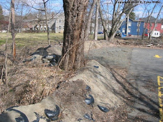
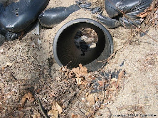
Last March (March 6) I was out for a walk along the Delaware River when the River was at what is known as bankfull. We had just had a significant amount of rain and there was the possibility of even more rain a couple of days later. Bankfull is as what you think. This is when a river or stream is near the top of its bank, just shy of flood stage. Residents in floodprone towns including but not limited to Frenchtown and Lambertville prepared for the floods by sandbagging vulnerable areas.

So, if the substantial rainfall that was predicted a couple of days later, the river would flood for (I think) the fourth time in four years. The predicted significant rainfall did not materialize, fortunately.

By March 15, the river was back down. I drove down with my friend to get some pictures of the River at more normal levels to provide a contrast with the pictures I got on March 6 when the River was at bankfull. We saw the sandbags that I photographed, in either Lambertville or Frenchtown. I got these shots. I was interested in the culvert which may have been the source of flooding in the adjacent parking lot.

I'll post the before and after pictures tomorrow.